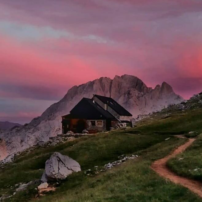
A linear route of moderate/high difficulty to visit the Diego Mella Refuge, also known as Collado Jermoso. It is located in the Central Massif of the Picos de Europa at 2,064 m, on a balcony more than 1,000 m above the Valdeón valley. This route is recommended for individuals with mountain experience and a familiarity with hiking.
Details of the hike
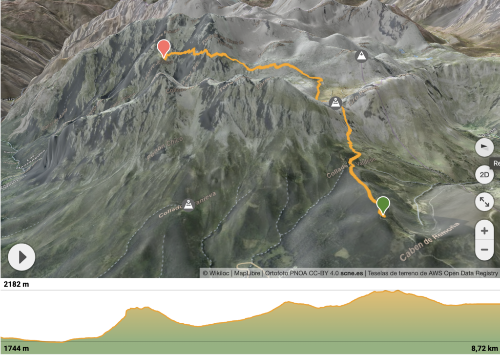
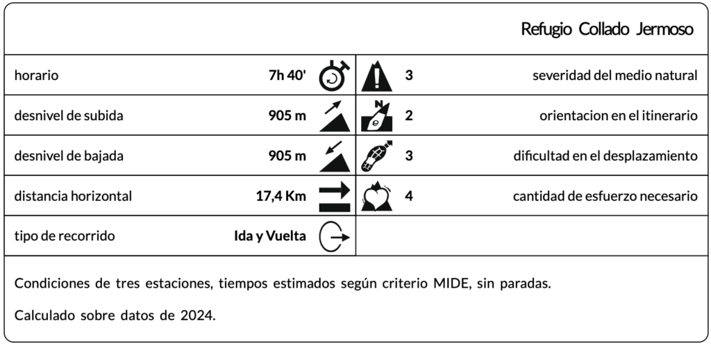
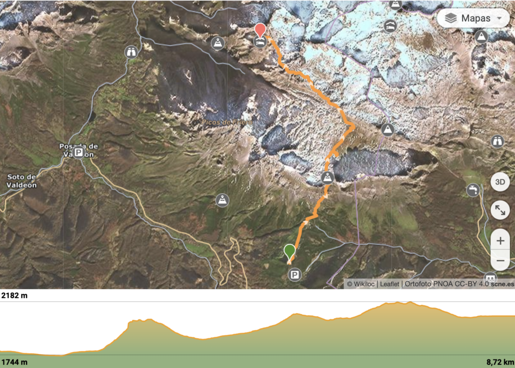
Distance: 8.72 km
Elevation gain: 594 m
Technical difficulty: Moderate
Elevation loss: 311 m
Maximum altitude: 2,182 m
Minimum altitude: 1,744 m
Route type: Linear
Hike description
The journey begins at Cabén de Remoña, where the track turns into a trail that ascends through scrubland until reaching the meadows of Pedabejo. Along this section, on the left, you pass a wooden livestock enclosure and, a few meters below, a watering trough. This is the last opportunity to refill water before reaching the refuge; in summer, if the drought is severe, there may be no water available.
Next, if you follow the main trail, it descends slightly to enter the Pedabejo gully, located beneath an impressive smooth rock wall. This gully has little exposure and a steady ascent; it is often used for mule transit to the refuge.
There is a more direct alternative by ascending via the Sedo de Remoña. Although it is more exposed, its route is more attractive. To access it, you must turn left, climb up the scree, and head toward the base of the crag, following the trail markers.
Both routes converge at the top, from where you ascend to a pass that offers one of the best views of the route: the Vega de Liordes and the Llambrión massif unfold before you.
The next section involves a descent to a junction. Here, you can choose to skirt the Vega de Liordes along the upper part, maintaining altitude, or descend into the vega and cross it, which involves losing more elevation than you will have to regain later.
After crossing the Vega, it is important to pay attention and head toward a wooden sign indicating the start of the climb via the Sedo de la Padierna, a short section along the rock. At this point, the trail joins the one coming from Fuente Dé and also connects with the Canal de la Sotín, which descends toward Cordiñanes. Once past the sedo, the path levels out before the final climb to Las Colladinas, where several switchbacks help gain elevation. On the right, snowfields often remain, which are common resting places for chamois.
Las Colladinas are five small passes suspended above the abyss. This section can be tricky in winter or with heavy snow, though in summer it poses no difficulty. From the second-to-last pass, you get one of the best views of the refuge.
From here, it is just a short walk to your destination—enjoy and rest.
Discover other hikes in the Valdeón valley, the heart of the Picos de Europa.
![]() Follow the hike Refugio Collado Jermoso
Follow the hike Refugio Collado Jermoso
![]() Follow the hike Refugio Collado Jermoso
Follow the hike Refugio Collado Jermoso

SEE VIDEO  SEE VIDEO
Possible Variant
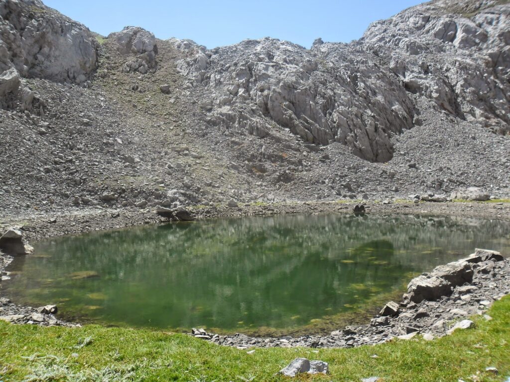
A possible variant in the itinerary is to visit Lago Cimero by deviating from the original route to discover this unique site.
Hike details:
• Colladina (0.9 km)
• Las Colladinas (1.2 km)
• Lago Cimero (1.7 km)
• Collado de la Padierna (3.1 km)
• Collado Remoña (4.6 km)
• Fuente Pedavejo (5.6 km)
• Collado de Valdeón (6.1 km)