A simple and accessible circular route for families with children or pets, starting from Camping el Cares to Santa Marina de Valdeón. It has a short distance and little elevation gain, making it ideal for beginners on the valley’s trails or for taking a gentle walk to warm up before tackling more challenging routes in the area.
General rating: EASY
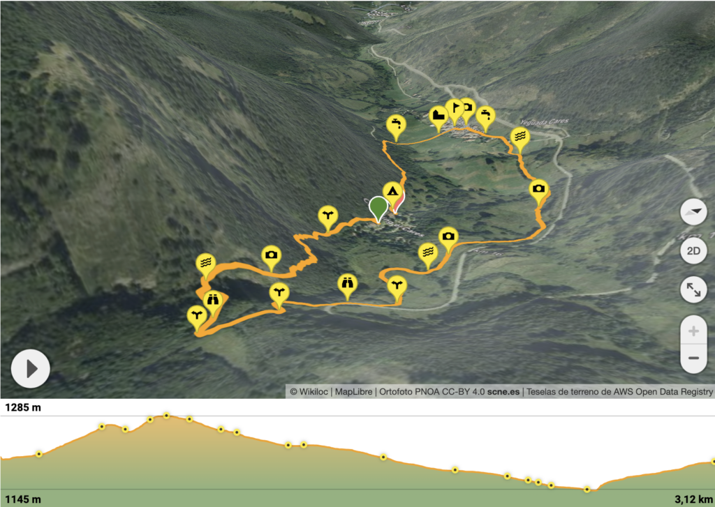
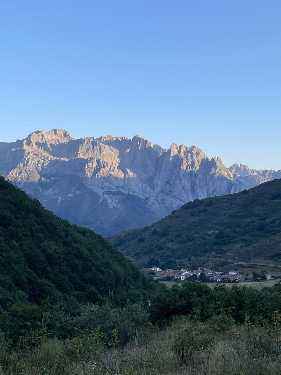
The Circular Route from Camping el Cares is a very easy family-friendly trail that is also quite complete due to the charm provided by the striking changes in landscape throughout the entire route, as well as the stunning panoramic views that gradually appear of the Central and Western massifs. The beech forest of Peña de las Cabras, the Arenal River, and the meadows surrounding the campsite up to Santa Marina de Valdeón are the three altitude levels you will cross along this easy path, which presents no particular difficulties.
For all these reasons and more, we recommend this route for all types of people, including children and pets, as a simple and enjoyable walk-ideal for getting started in the Valdeón Valley, discovering the local flora and fauna around the campsite, and warming up for the various longer or more challenging routes we suggest, since this circular route can also be connected with other trails you will find here.
Details of the hike
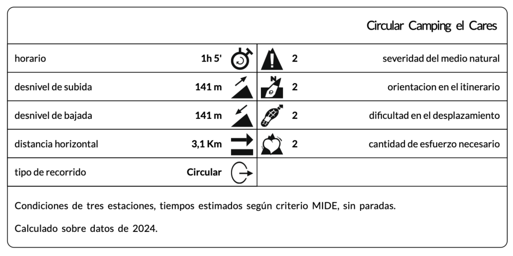
Type of route: Circular
Distance: 3.12 km
Elevation gain: 141 m
Elevation loss: 141 m
Max altitude: 1,285 m
Min altitude: 1,145 m
Description of the route
The Camping el Cares circular route begins at the entrance to the campsite. Exit the campsite and immediately head left, walking behind the reception building. After a few meters, you will see the back door of our restaurant and, to its right, the start of a small path where this route begins.
First, you will enter the beech forest so characteristic of the National Park, which in our area is home to the Iberian fox, badger, and wildcat. In this forest, impressive and long-lived beeches-whose bark tells the history of this mountain-almost completely cover the view of the sky.
During this walk through the woods, especially in the first few meters, you will find some forks in the path; always choose the path to the right, which allows you to continue uphill through the forest and discover along the way the unique growth patterns of these trees and their relationship with the wide variety of mosses, lichens, and fungi that grow in their shade.
You will also be able to observe the different tracks and marks left by the animals that share this route, as well as the songs of the various birds that accompany you along the way-a reflection of the vibrant wildlife in this particular mountain. You may also spot medicinal and edible plants.
You will leave this first part of the route through the forest when you come to a large slate rock, where the change in substrate completely alters the vegetation. At this point, a small clearing opens in the cliff, revealing a landscape where you can find various types of shrubs, flowering plants such as wild rose, and several lizards and insects common here, associated with this type of rock and flora.
Continue along the path, descending carefully down a slate trail. This path will bring you to the crossing of the Arenal River, an ideal spot to observe the different amphibians and reptiles that inhabit its crystal-clear waters. You will cross the river easily, finding the continuation of the route directly on the other side. Climb a short zigzag up a narrow forest path until you reach a much wider country track.
Here, it is important to pay attention and turn left, descending along this track toward Santa Marina de Valdeón, instead of continuing the ascent you were following from the river.
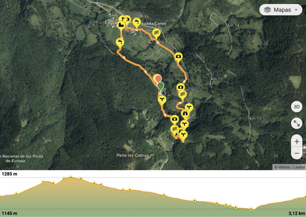
At this point, with half of the route already behind us, we will descend along this path until we reach the main road, which we will avoid by following small trails found to our left. These trails will lead us down to the various meadows surrounding the campsite, offering wide panoramic views of the Western massif, with the village of Santa Marina at its feet.
We will cross these flower-filled meadows-home to hares, roe deer, and wild boar-until we reach the upper part of the village via a well-marked path lined with hazel trees, blueberries, and cherry trees, among other edible plants such as strawberries, blackberries, or wild raspberries. To our left, we’ll always see the fields where local shepherds practice traditional extensive livestock farming.
Once the path ends, we will cross the village of Santa Marina until we reach a beautiful hórreo (traditional granary), from where we’ll take a small shortcut back to the campsite, as indicated by the route. To do this, we’ll cross a wide meadow that leads to the Fuente del Rejo, crossing a small bridge beforehand. From here, we’ll find a path to the right that quickly connects us to the campsite road, thus completing this small but, at the same time, great route for discovering the area, its wildlife, and its flora-whether alone or with family.
Any specific recommendations for this hike?
Although this route does not present any technical difficulties, there is a very easy river crossing halfway along the route and a cattle crossing in the last few meters of the trail before reaching the village. Therefore, to avoid any possible inconvenience, we recommend wearing sports or hiking shoes, preferably with non-slip soles and, if possible, some waterproof component. In addition, although it is not essential in this case, we would suggest bringing a container of water, as the first fountain is not found until you reach the village, almost at the end of the route.
Discover other hikes in the Valdeón valley, the heart of the Picos de Europa
![]() Follow the ruta circular Camping el Cares
Follow the ruta circular Camping el Cares
![]() Follow the Ruta circular Camping el Cares
Follow the Ruta circular Camping el Cares

SEE VIDEO  SEE VIDEO